Post

Log inSign up

Post

Log inSign up

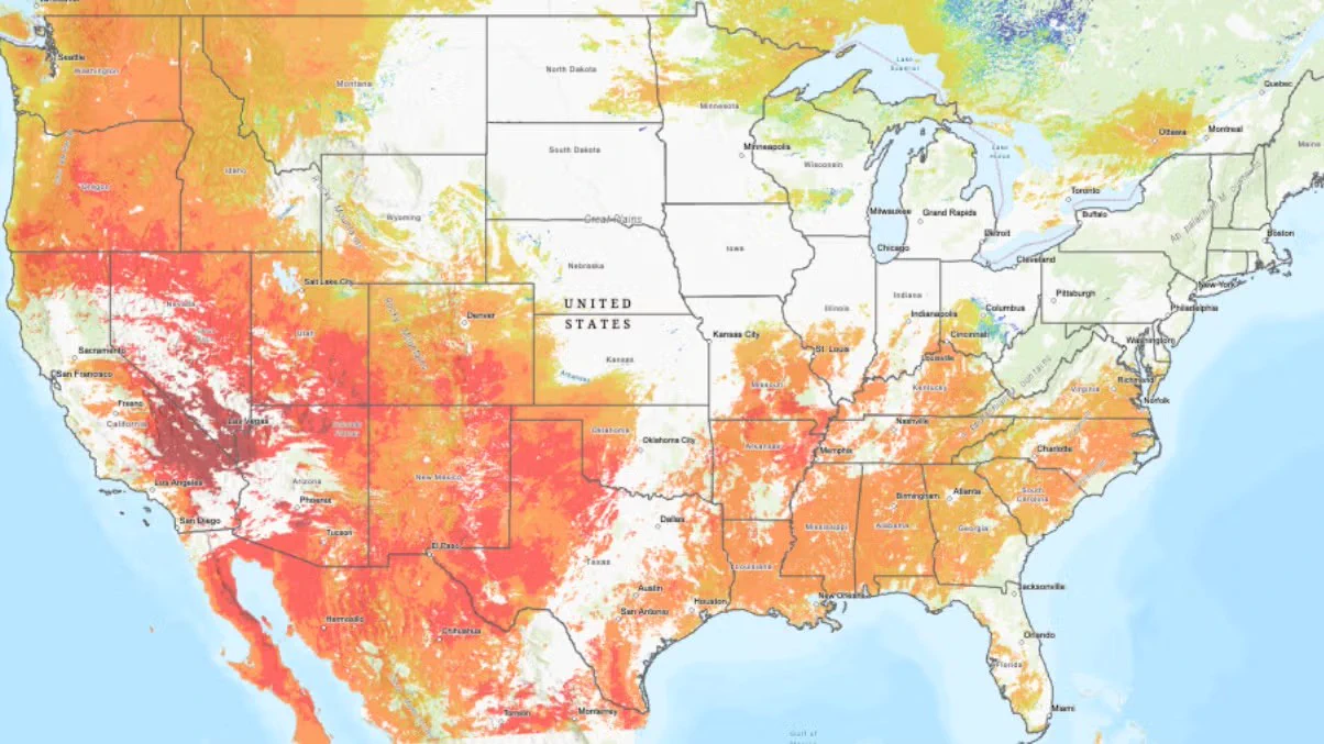
NSF National Center for Atmospheric Research on X: "Since dryness is a critical driver of wildfires, a team of NSF NCAR scientists created a wildfire risk map, updated in real time & open source, to show a detailed view of the moisture content of different types of vegetation across the US & adjacent areas. https://t.co/NoUArhsIBk"

@NCAR_Science
NSF National Center for Atmospheric Research
@NCAR_Science
Since dryness is a critical driver of wildfires, a team of NSF NCAR scientists created a wildfire risk map, updated in real time & open source, to show a detailed view of the moisture content of different types of vegetation across the US & adjacent areas. bit.ly/4hAfW8Z
7:36 PM · Sep 28, 2026·
750
Views

Log in or sign up for X

See what’s happening and join the conversation

Continue with phone
or
Log in with username or email

Relevant people

Avatar
NSF National Center for Atmospheric Research@NCAR_ScienceFollow
At @NSF NCAR, we study the Earth system, from oceans to exosphere: weather, water, climate, air quality, space weather + more. Operated by @UCAR_News #NSFfunded

Trending now

Terms·Privacy·Cookies·Accessibility·US TIDA·Ads Info·© 2026 X Corp.
  • @NCAR_Science
    NSF National Center for Atmospheric Research
    @NCAR_Science
    Since dryness is a critical driver of wildfires, a team of NSF NCAR scientists created a wildfire risk map, updated in real time & open source, to show a detailed view of the moisture content of different types of vegetation across the US & adjacent areas. bit.ly/4hAfW8Z
    7:36 PM · Sep 28, 2026·
    750
    Views