


Volcano Science Center
Find U.S. Volcano
The Volcano Science Center is the primary center serving the mission of the USGS Volcano Hazards Program — to enhance public safety and minimize social and economic disruption from volcanic unrest and eruption. The center is home to the five US volcano observatories with offices in Anchorage, Alaska; Menlo Park and Mountain View, California; Vancouver, Washington; and Hilo, Hawaii.


News
New USGS data release on Kīlauea lava fountain heights
New USGS data release on Kīlauea lava fountain heights
Volcano Watch — Ruby seamount: A glimpse into the secret life of a submarine volcano
Volcano Watch — Ruby seamount: A glimpse into the secret life of a submarine volcano
Crystal clues: The case of the Lava Creek Tuff’s missing members
Crystal clues: The case of the Lava Creek Tuff’s missing members
Publications
Evolution of summit magma pressure during the 2018 caldera collapse at Kılauea volcano Evolution of summit magma pressure during the 2018 caldera collapse at Kılauea volcano
We utilized geodetic data from the 16 May to 4 August 2018 caldera collapse sequence to refine the geometries and pressure evolution of two summit reservoirs at Kīlauea volcano: the shallower Halema‘uma‘u (HMM) and deeper South Caldera (SC) reservoirs. We modeled magma reservoirs as pressurized spheroidal cavities and constrained reservoir geometries with Global Positioning System (GPS)...
Microgravity measurements spanning 2019–2022 indicate no change in magma supply or storage during Kilauea's reawakening Microgravity measurements spanning 2019–2022 indicate no change in magma supply or storage during Kilauea's reawakening
After more than 2 years of quiescence following its major 2018 flank lava effusion and summit caldera collapse, Kīlauea, Hawaiʻi, returned to frequent eruptive activity in late 2020. Microgravity measurements from the summit region in 2019 and 2022 span this reawakening and indicate a gravity increase of up to hundreds of microgals near the center of the summit caldera. Much of this...
Geophysical insights into Kīlauea’s eruptive reawakening after its 2018 eruption and caldera collapse Geophysical insights into Kīlauea’s eruptive reawakening after its 2018 eruption and caldera collapse
A little more than two years after the destructive 2018 lower East Rift Zone eruption and summit collapse ended, renewed volcanic activity began at Kīlauea volcano, Hawaiʻi. During 2020–2025, activity at the volcano included six eruptions in the summit caldera, one in the Southwest Rift Zone, and one in the middle East Rift Zone, as well as multiple non-eruptive intrusions in all three...
Science
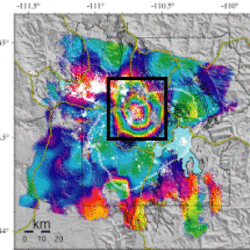
Uplift along the north rim of Yellowstone Caldera
An area on the north rim of Yellowstone caldera, to the south of Norris Geyser Basin, started to uplift slightly in July 2025. Similar deformation occurred in the same area during 1996-2004 and reveals characteristics of the subsurface.
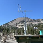
USGS volcano-hydrothermal fluid chemistry data
The USGS has published chemistry data for volcanic and hydrothermal fluids sampled at sites around the United States.

How are lava flows mapped in Hawaii?
Lava flow mapping provides situational awareness of volcanic eruptive hazards in Hawaii. During eruptions, USGS Hawaiian Volcano Observatory (HVO) scientists employ a variety of techniques to collect and disseminate map data depicting key eruptive features, especially lava flows.