
Log inSign up
Log inSign up
National Weather Service
47.1K posts
National Weather Service profile banner
@NWS

National Weather Service

@NWS
Official X account for @NOAA's National Weather Service. A list of official NWS accounts can be found at x.com/i/lists/725042…
United States
weather.gov
Joined January 2012
323 Following
3.1M Followers
RepliesRepliesRepostsRepostsMediaMedia

Log in or sign up for X

See what’s happening and join the conversation

Continue with phone
or
Log in with username or email
Terms·Privacy·Cookies·Accessibility·US TIDA·Ads Info·© 2026 X Corp.
  • @NWS
    National Weather Service
    @NWS
    15h
    Tropical Storm Rachel will bring hazardous conditions to Baja California and the Southwest this weekend, including damaging winds, flash flooding, and life-threatening surf and rip currents. Coastal flooding and erosion are also expected to worsen. hurricanes.gov
    National Hurricane Center forecast issued at 11 AM PDT October 10, 2026, showing Tropical Storm Rachel over the Pacific Ocean southwest of Baja California, with maximum sustained winds of 60 mph and moving northeast at 22 mph. Rachel is forecast to approach the northern Baja California coast Sunday morning before weakening to a tropical depression over the southwestern United States by Sunday evening. Tropical storm warnings (blue) and watches (yellow) are in effect for portions of Baja California and Southern California. The white cone shows the probable path of the storm's center, not the full extent of hazardous conditions.
    8
  • @NWS
    National Weather Service
    @NWS
    20h
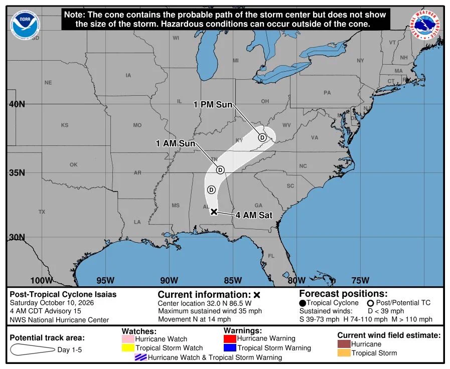
    Heavy rainfall associated with the post-tropical remnants of #Isaias will be spreading quickly northward into the Tennessee Valley, Southern Appalachians and Southeast today. Considerable flash and urban flooding will be possible. Landslides are also possible across the
    National Hurricane Center forecast issued at 4 AM CDT October 10, 2026, showing Post-Tropical Cyclone Isaias over southeastern Alabama with maximum sustained winds of 35 mph, moving north at 14 mph. The forecast track takes the system north through Alabama and Tennessee, then northeast toward Kentucky and West Virginia by Sunday afternoon. The white cone indicates uncertainty in the storm center's path, not the full extent of hazardous weather.
    4
  • @NWS
    National Weather Service
    @NWS
    Oct 10
    10PM CT update on #Isaias: A life-threatening storm surge is expected from Dauphin Island, Alabama, to Suwannee, Florida where a Storm Surge Warning remains in effect. Residents in the warning area should continue to follow advice given by local officials. Extremely dangerous
    National Hurricane Center forecast issued at 10 PM CDT October 9, 2026, showing Hurricane Isaias near the Florida Panhandle with maximum sustained winds of 90 mph, moving north at 20 mph. The forecast track takes Isaias inland through Alabama and Tennessee, then northeast toward Kentucky and West Virginia through Sunday evening. Hurricane warnings (red) and tropical storm warnings (blue) cover portions of the northern Gulf Coast and inland areas. The white cone represents uncertainty in the storm center's path, not the full extent of hazardous conditions.
    NOAA Weather Prediction Center map showing the greatest flash flood risk from Hurricane Isaias over the next three days, October 9–12, 2026. Moderate risk areas (red) extend along the Gulf Coast from near Mobile, Alabama, into the Florida Panhandle, with another area around Atlanta and northward toward Chattanooga. Slight risk (yellow) covers much of Alabama, Georgia, and portions of neighboring states, surrounded by broader marginal risk areas (green). Smaller maps show how the flash flood threat shifts each day.
    NOAA Storm Prediction Center severe weather outlook for Saturday, October 10, 2026. A Slight Risk (yellow, level 2 of 5) covers portions of southern Georgia, southeastern Alabama, the Florida Panhandle, and southern South Carolina, including areas near Tallahassee and Charleston. A surrounding Marginal Risk (dark green, level 1 of 5) extends across parts of the Southeast and coastal Carolinas. General thunderstorms (light green) are possible across much of the eastern U.S., Florida, and portions of Arizona and New Mexico. The outlook is valid through 7 AM CDT Sunday, October 11.
    4
  • @NWS
    National Weather Service
    @NWS
    Oct 10
    NWS Doppler Radar data indicate that Hurricane Isaias made landfall near Destin, Florida, around 830 PM CDT with maximum sustained winds of 105 mph (165 km/h). The estimated minimum central pressure is 971 mb (28.67 inches). See more at hurricanes.gov
    NOAA GOES-19 satellite imagery of Hurricane Isaias over the northern Gulf Coast on October 10, 2026, at 0120 UTC. A large, organized mass of clouds and thunderstorms covers southern Alabama, Georgia, the Florida Panhandle, and surrounding areas. Bright orange and yellow colors highlight the coldest, highest cloud tops associated with intense thunderstorms, while green and blue shades indicate surrounding cloud cover.
    10
  • @NWS
    National Weather Service
    @NWS
    Oct 9
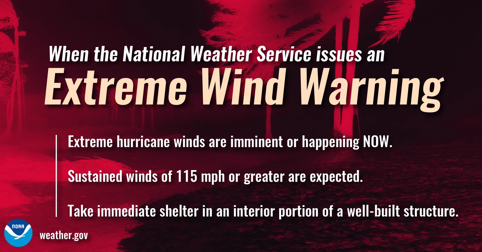
    An Extreme Wind Warning has been issued for portions of the Florida Panhandle as #Isaias approaches. Hurricane force winds are imminent in these regions. Treat this as you would a tornado warning and get into your safe place immediately!